Difference between revisions of "Category:Terrain Information"
From DCS World Wiki - Hoggitworld.com
| (6 intermediate revisions by the same user not shown) | |||
| Line 234: | Line 234: | ||
|list= | |list= | ||
| + | |||
| Line 295: | Line 296: | ||
59 : Kharab Ishk | 59 : Kharab Ishk | ||
60 : Tal Siman | 60 : Tal Siman | ||
| − | + | 63 : At Tanf | |
| − | + | 64 : Prince Hassan | |
| − | + | 65 : King Abdullah II | |
| + | 66 : Herzliya | ||
| + | 67 : Amman | ||
| + | 68 : Muwaffaq Salti | ||
| Line 303: | Line 307: | ||
|note= | |note= | ||
| + | |||
| + | 2.9.3 Added ids 64-68 | ||
}} | }} | ||
{{Template:dcs_maps_scripting | {{Template:dcs_maps_scripting | ||
| Line 369: | Line 375: | ||
Airbase list is as of DCS 2.8.4. | Airbase list is as of DCS 2.8.4. | ||
| + | |||
| + | }} | ||
| + | |||
| + | {{Template:dcs_maps_scripting | ||
| + | |||
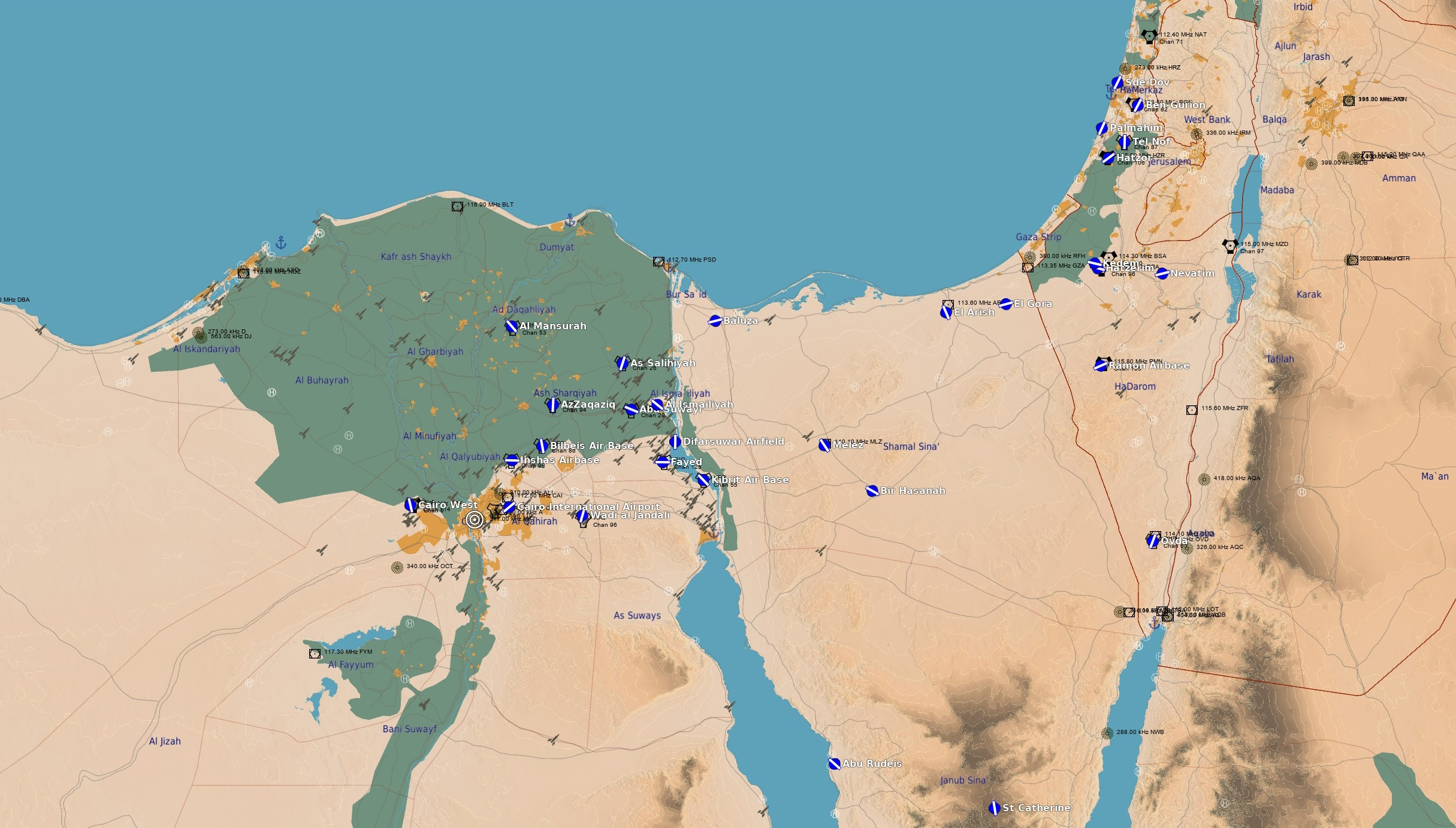
| + | |name= Sinai | ||
| + | |||
| + | |desc= The territory includes the entire Sinai Peninsula, eastern Egypt, the Nile Delta, the southern part of Israel, the west of Jordan and Saudi Arabia, Palestine - the Gaza Strip. This area includes many airbases, urban areas, wide variety of landscapes such as mountains, desert, sea and bays. | ||
| + | |||
| + | |list= | ||
| + | |||
| + | |||
| + | 1 : Difarsuwar Airfield | ||
| + | 2 : Abu Suwayr | ||
| + | 3 : As Salihiyah | ||
| + | 4 : Al Ismailiyah | ||
| + | 5 : Melez | ||
| + | 6 : Fayed | ||
| + | 7 : Hatzerim | ||
| + | 8 : Nevatim | ||
| + | 9 : Ramon Airbase | ||
| + | 10 : Ovda | ||
| + | 11 : Kibrit Air Base | ||
| + | 12 : Kedem | ||
| + | 13 : Wadi al Jandali | ||
| + | 14 : Al Mansurah | ||
| + | 15 : AzZaqaziq | ||
| + | 16 : Bilbeis Air Base | ||
| + | 17 : Cairo International Airport | ||
| + | 18 : Cairo West | ||
| + | 19 : Inshas Airbase | ||
| + | 20 : Hatzor | ||
| + | 21 : Palmachim | ||
| + | 22 : Sde Dov | ||
| + | 23 : Tel Nof | ||
| + | 24 : Ben-Gurion | ||
| + | 25 : St Catherine | ||
| + | 26 : Abu Rudeis | ||
| + | 27 : Baluza | ||
| + | 28 : Bir Hasanah | ||
| + | 29 : El Arish | ||
| + | 30 : El Gora | ||
| + | 31 : Al Khatatbah | ||
| + | 32 : Al Rahmaniyah Air Base | ||
| + | 33 : Beni Suef | ||
| + | 34 : Birma Air Base | ||
| + | 35 : Borj El Arab International Airport | ||
| + | 36 : El Minya | ||
| + | 37 : Gebel El Basur Air Base | ||
| + | 38 : Hurghada International Airport | ||
| + | 39 : Jiyanklis Air Base | ||
| + | 40 : Kom Awshim | ||
| + | 41 : Ramon International Airport | ||
| + | 42 : Sharm El Sheikh International Airport | ||
| + | 43 : Wadi Abu Rish | ||
| + | 44 : Al Bahr al Ahmar | ||
| + | 45 : Quwaysina | ||
| + | |||
| + | |mapImage= [[File:Sinai_map_origin.jpg|200px|thumb]] | ||
| + | |||
| + | |note= Map origin is located in Cairo, Egypt. | ||
| + | |||
| + | Airbase list is as of DCS 2.9.7 | ||
| + | |||
| + | }} | ||
| + | |||
| + | {{Template:dcs_maps_scripting | ||
| + | |||
| + | |name= Kola Peninsula | ||
| + | |||
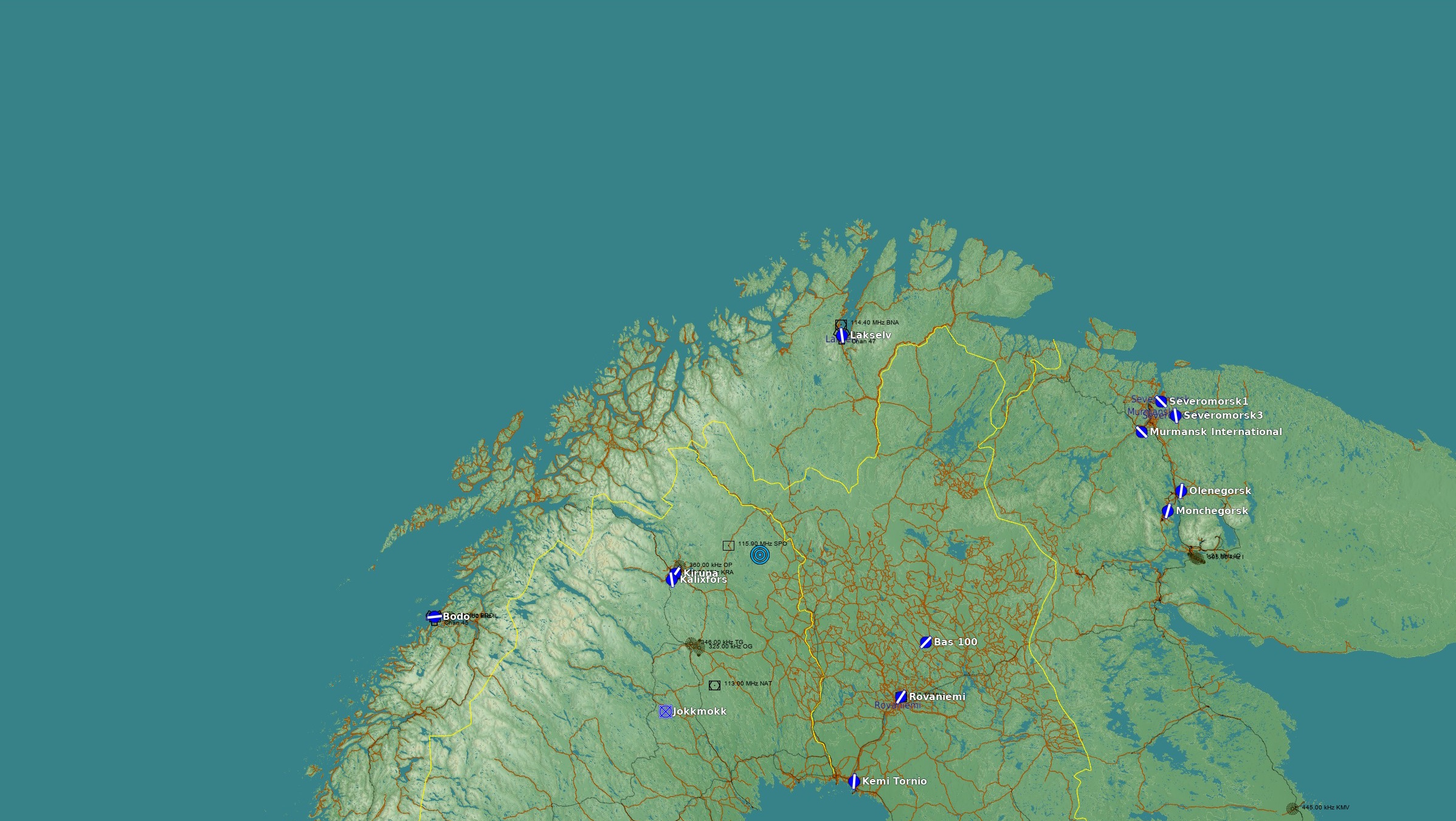
| + | |desc= The Kola map covers northern Norway, Sweden, and Finland, as well as Murmansk and parts of the Karelia regions of northwestern Russia. The map also includes large portions of the Barents Sea and Norwegian Sea to the north and west. | ||
| + | |||
| + | |list= | ||
| + | |||
| + | |||
| + | 1 : Lakselv | ||
| + | 2 : Rovaniemi | ||
| + | 3 : Kemi Tornio | ||
| + | 4 : Bas 100 | ||
| + | 5 : Kiruna | ||
| + | 6 : Severomorsk3 | ||
| + | 7 : Bodo | ||
| + | 8 : Severomorsk1 | ||
| + | 9 : Olenegorsk | ||
| + | 10 : Monchegorsk | ||
| + | 11 : Jokkmokk | ||
| + | 12 : Murmansk International | ||
| + | 13 : Kalixfors | ||
| + | |||
| + | |mapImage= [[File:Kola_map_origin.jpg|200px|thumb]] | ||
| + | |||
| + | |note= Map origin is located near the Swedish and Finish boarder in the middle of nowhere. | ||
| + | |||
| + | Airbase list is as of DCS 2.9.4. | ||
| + | |||
| + | }} | ||
| + | |||
| + | {{Template:dcs_maps_scripting | ||
| + | |||
| + | |name= Cold War Germany | ||
| + | |||
| + | |desc= The Cold War Germany covers the territory of Central Europe and includes FRG and GDR, Poland, Czech Republic, Denmark and the Baltic Sea. The period 1970-1990, which was the peak of the arms race, is represented, as well as earlier and later historical periods. The size of the map is 980 km north to south and 800 km east to west, giving a total area of 784,000 square kilometers. More than 100 airfields are represented on the map. | ||
| + | |||
| + | |list= | ||
| + | |||
| + | 1 : Wittstock | ||
| + | 2 : Altes Lager | ||
| + | 3 : Barth | ||
| + | 4 : Zerbst | ||
| + | 5 : Bremen | ||
| + | 6 : Briest | ||
| + | 7 : Buckeburg | ||
| + | 8 : Celle | ||
| + | 9 : Cochstedt | ||
| + | 10 : Damgarten | ||
| + | 11 : Fassberg | ||
| + | 12 : Finow | ||
| + | 13 : Garz | ||
| + | 14 : Gatow | ||
| + | 15 : Templin | ||
| + | 16 : Gutersloh | ||
| + | 17 : Hamburg | ||
| + | 18 : Hamburg Finkenwerder | ||
| + | 19 : Hannover | ||
| + | 20 : Laage | ||
| + | 21 : Larz | ||
| + | 22 : Mahlwinkel | ||
| + | 23 : Neubrandenburg | ||
| + | 24 : Neuruppin | ||
| + | 25 : Peenemunde | ||
| + | 26 : Schonefeld | ||
| + | 27 : Stendal | ||
| + | 28 : Tegel | ||
| + | 29 : Tempelhof | ||
| + | 30 : Tutow | ||
| + | 31 : Werneuchen | ||
| + | 32 : Wunstorf | ||
| + | 53 : H FRG 01 | ||
| + | 54 : H FRG 02 | ||
| + | 55 : H FRG 03 | ||
| + | 56 : H FRG 04 | ||
| + | 57 : H FRG 05 | ||
| + | 58 : H FRG 06 | ||
| + | 59 : H FRG 07 | ||
| + | 60 : H FRG 08 | ||
| + | 61 : H FRG 09 | ||
| + | 62 : H FRG 10 | ||
| + | 64 : H FRG 12 | ||
| + | 65 : H FRG 13 | ||
| + | 66 : H FRG 14 | ||
| + | 67 : H GDR 01 | ||
| + | 68 : H GDR 02 | ||
| + | 69 : H GDR 03 | ||
| + | 70 : H GDR 04 | ||
| + | 71 : H GDR 05 | ||
| + | 72 : H GDR 06 | ||
| + | 73 : H GDR 07 | ||
| + | 74 : H GDR 08 | ||
| + | 75 : H GDR 09 | ||
| + | 76 : H GDR 10 | ||
| + | 77 : H GDR 11 | ||
| + | 78 : H FRG 15 | ||
| + | 80 : Gross Mohrdorf | ||
| + | 81 : Lubeck | ||
| + | 82 : Kothen | ||
| + | 83 : Dessau | ||
| + | 84 : Parchim | ||
| + | 85 : H GDR 12 | ||
| + | 86 : Uetersen | ||
| + | 89 : Luneburg | ||
| + | 90 : Northeim | ||
| + | 91 : H GDR 13 | ||
| + | 92 : H GDR 14 | ||
| + | 93 : H GDR 15 | ||
| + | 94 : H GDR 16 | ||
| + | 95 : H GDR 17 | ||
| + | 96 : H FRG 16 | ||
| + | 97 : H FRG 17 | ||
| + | 98 : H FRG 18 | ||
| + | 99 : H FRG 19 | ||
| + | 100 : H FRG 11 | ||
| + | 101 : Sperenberg | ||
| + | 102 : Uelzen | ||
| + | 103 : Dedelow | ||
| + | 104 : Kammermark | ||
| + | 106 : Weser Wumme | ||
| + | 107 : Braunschweig | ||
| + | 108 : Wismar | ||
| + | 109 : Waren Vielist | ||
| + | 110 : Bienenfarm | ||
| + | 111 : Pinnow | ||
| + | 112 : Gardelegen | ||
| + | 113 : Glindbruchkippe | ||
| + | 114 : Ummern | ||
| + | 115 : Hildesheim | ||
| + | 116 : Verden-Scharnhorst | ||
| + | 117 : Rinteln | ||
| + | 118 : Holzdorf | ||
| + | 119 : H Med GDR 01 | ||
| + | 120 : H Med GDR 02 | ||
| + | 121 : H Med GDR 03 | ||
| + | 122 : H GDR 33 | ||
| + | 123 : Airracing Koblenz | ||
| + | 124 : H GDR 34 | ||
| + | 126 : H Med GDR 08 | ||
| + | 127 : H Med GDR 09 | ||
| + | 128 : H Med GDR 10 | ||
| + | 129 : H Med FRG 01 | ||
| + | 130 : H Med FRG 02 | ||
| + | 132 : H Med FRG 04 | ||
| + | 134 : H Med FRG 06 | ||
| + | 139 : H Med FRG 11 | ||
| + | 140 : Hasselfelde | ||
| + | 141 : Grosse Wiese | ||
| + | 142 : H GDR 18 | ||
| + | 143 : H FRG 20 | ||
| + | 144 : H Med FRG 12 | ||
| + | 145 : H GDR 19 | ||
| + | 146 : H GDR 30 | ||
| + | 147 : H Med GDR 11 | ||
| + | 148 : H FRG 21 | ||
| + | 149 : H FRG 50 | ||
| + | 150 : H FRG 23 | ||
| + | 151 : H FRG 39 | ||
| + | 152 : H GDR 21 | ||
| + | 153 : H GDR 22 | ||
| + | 154 : Fritzlar | ||
| + | 155 : Hahn | ||
| + | 156 : Sembach | ||
| + | 157 : Allstedt | ||
| + | 158 : Zweibrucken | ||
| + | 159 : Giebelstadt | ||
| + | 160 : Schweinfurt | ||
| + | 161 : Haina | ||
| + | 162 : Spangdahlem | ||
| + | 163 : Frankfurt | ||
| + | 164 : Bindersleben | ||
| + | 165 : Ramstein | ||
| + | 166 : Fulda | ||
| + | 167 : Obermehler Schlotheim | ||
| + | 168 : Mendig | ||
| + | 169 : Merseburg | ||
| + | 170 : Wiesbaden | ||
| + | 171 : Leipzig Halle | ||
| + | 180 : H Med GDR 12 | ||
| + | 181 : H Med GDR 13 | ||
| + | 182 : H Med GDR 14 | ||
| + | 184 : H Med GDR 16 | ||
| + | 185 : H GDR 24 | ||
| + | 186 : H Med FRG 13 | ||
| + | 187 : H Med FRG 14 | ||
| + | 188 : H Med FRG 15 | ||
| + | 189 : H Med FRG 16 | ||
| + | 190 : H Med FRG 17 | ||
| + | 191 : H FRG 25 | ||
| + | 193 : H Radar GDR 01 | ||
| + | 194 : H Radar GDR 02 | ||
| + | 195 : H Radar GDR 03 | ||
| + | 196 : H Radar GDR 04 | ||
| + | 197 : H Radar GDR 05 | ||
| + | 198 : H Radar GDR 06 | ||
| + | 199 : H Radar GDR 07 | ||
| + | 200 : Bitburg | ||
| + | 201 : Airracing Lubeck | ||
| + | 202 : H FRG 27 | ||
| + | 204 : Airracing Frankfurt | ||
| + | 208 : H Med FRG 21 | ||
| + | 211 : H FRG 30 | ||
| + | 212 : H FRG 31 | ||
| + | 213 : H FRG 32 | ||
| + | 215 : H FRG 34 | ||
| + | 218 : H FRG 51 | ||
| + | 219 : H FRG 38 | ||
| + | 220 : H FRG 48 | ||
| + | 221 : H FRG 49 | ||
| + | 222 : H Med FRG 24 | ||
| + | 223 : H Radar FRG 02 | ||
| + | 225 : H Med FRG 26 | ||
| + | 226 : H GDR 25 | ||
| + | 227 : H GDR 26 | ||
| + | 229 : H GDR 31 | ||
| + | 230 : H GDR 32 | ||
| + | 231 : H Med FRG 27 | ||
| + | 232 : Pferdsfeld | ||
| + | 233 : H Med FRG 29 | ||
| + | 234 : H FRG 40 | ||
| + | 235 : Buchel | ||
| + | 236 : Leipzig Mockau | ||
| + | 237 : H FRG 43 | ||
| + | 238 : H FRG 44 | ||
| + | 239 : H FRG 45 | ||
| + | 240 : H FRG 46 | ||
| + | 241 : H FRG 47 | ||
| + | 242 : Bad Durkheim | ||
| + | 243 : Gelnhausen | ||
| + | 244 : Herrenteich | ||
| + | 245 : Hockenheim | ||
| + | 246 : Langenselbold | ||
| + | 247 : Walldorf | ||
| + | 248 : Ober-Morlen | ||
| + | 249 : Pottschutthohe | ||
| + | 250 : Worms | ||
| + | 251 : H Radar GDR 09 | ||
| + | 252 : H Radar GDR 08 | ||
| + | 253 : H FRG 41 | ||
| + | 254 : H FRG 42 | ||
| + | |||
| + | |mapImage= | ||
| + | |||
| + | |note= | ||
}} | }} | ||
Latest revision as of 23:11, 5 June 2025
Contents
Caucuses
Nevada
Normandy
Persian Gulf
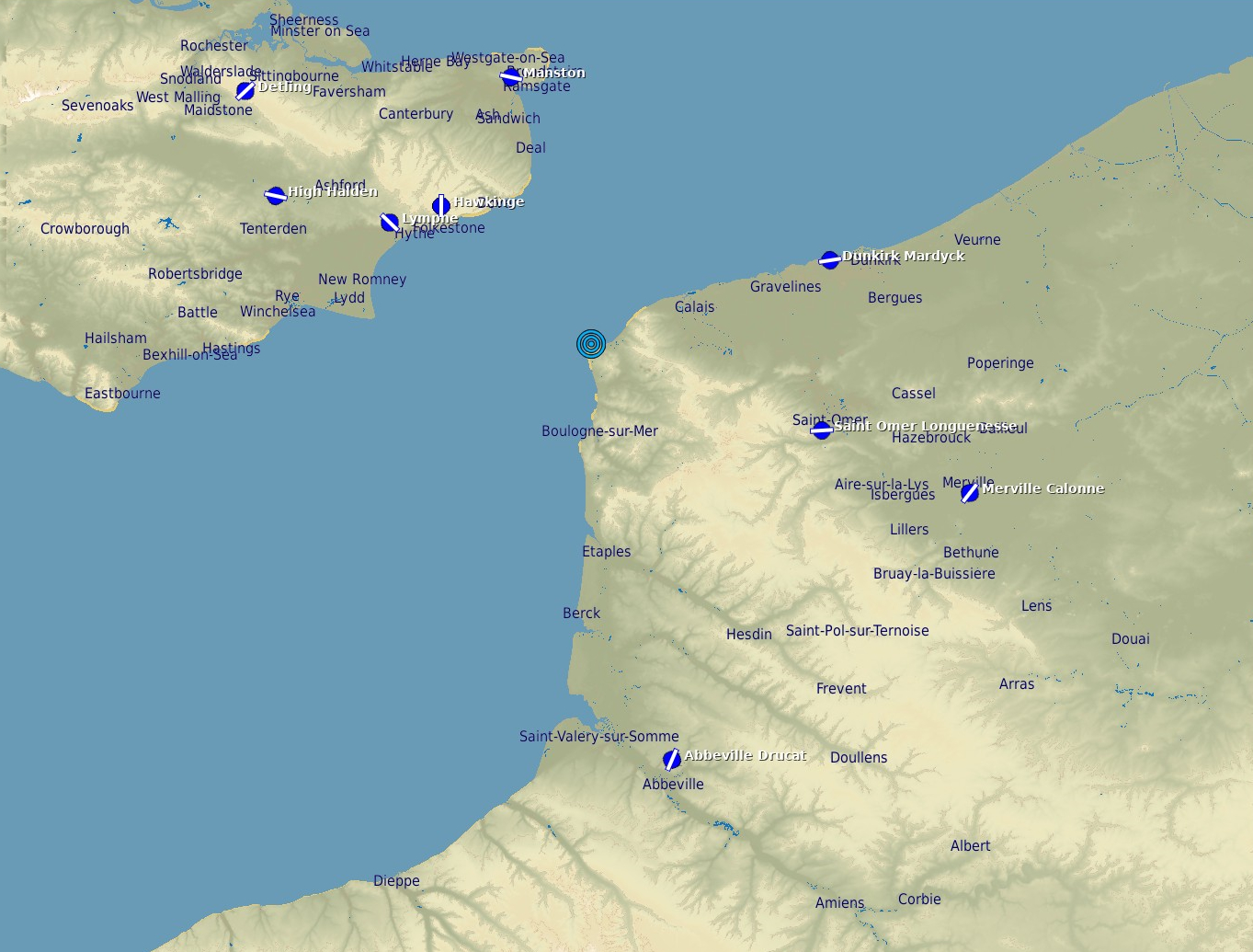
The Channel
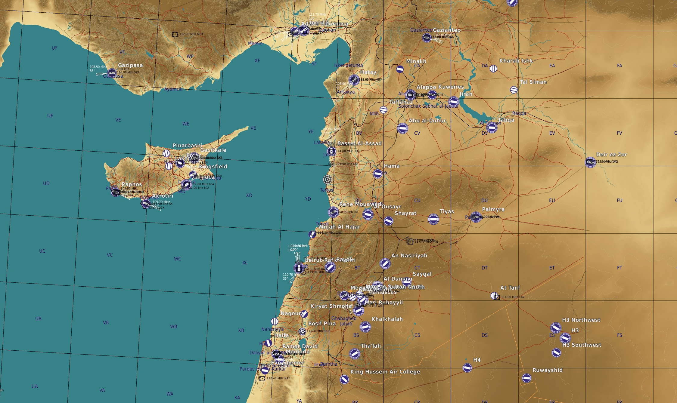
Syria
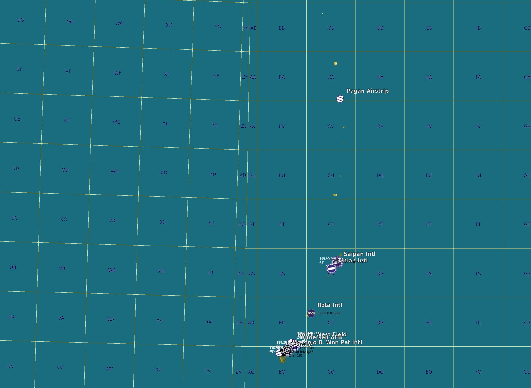
Marianas Islands
South Atlantic
Sinai
Kola Peninsula
Cold War Germany
This category currently contains no pages or media.

